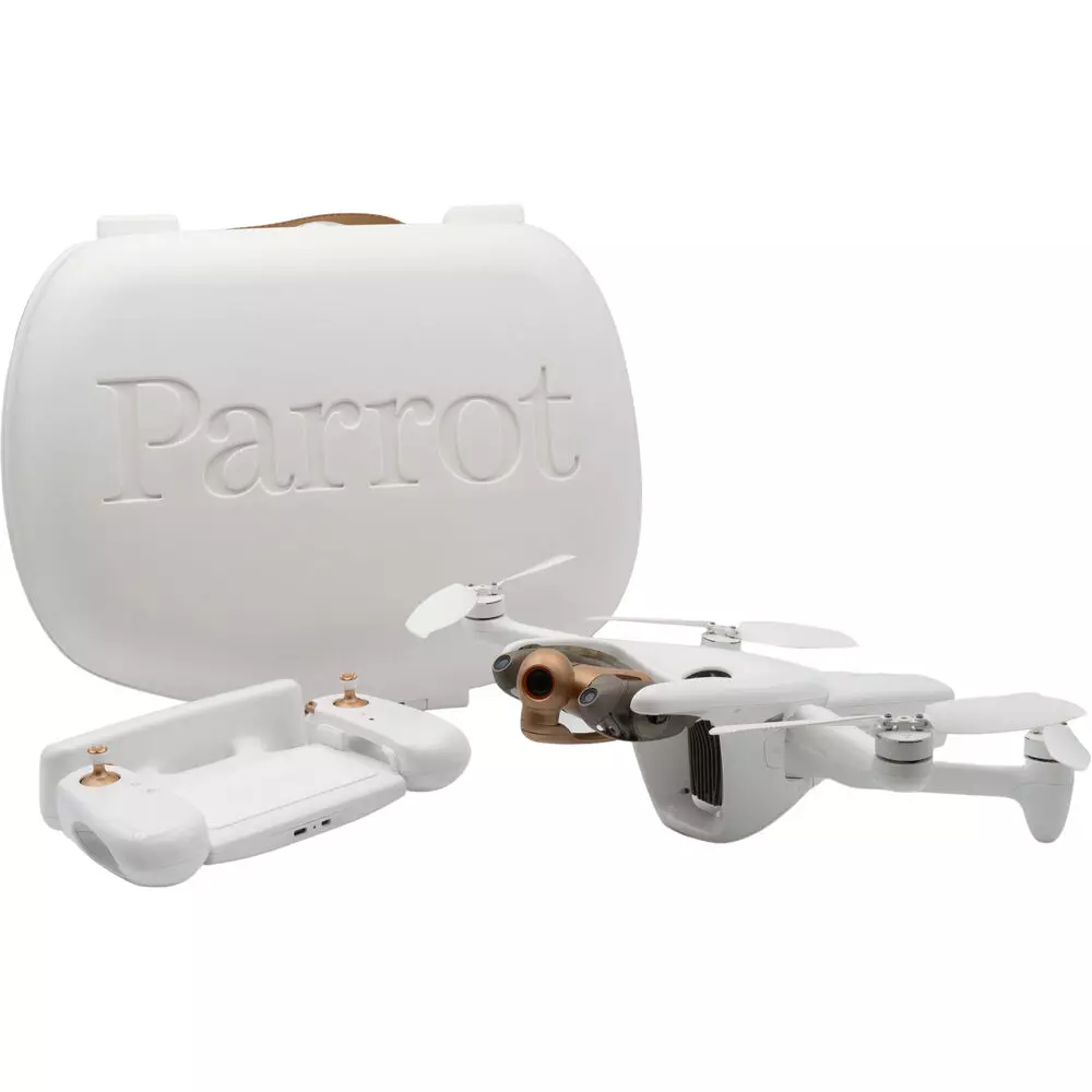
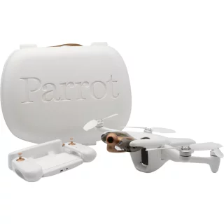
Parrot ANAFI Ai - Drone with 4G data connection


Tilaa saapumisilmoitus sähköpostiisi, niin saat heti tiedon kun tuotetta on jälleen saatavilla.

Parrot ANAFI Ai - Drone with 4G data connection
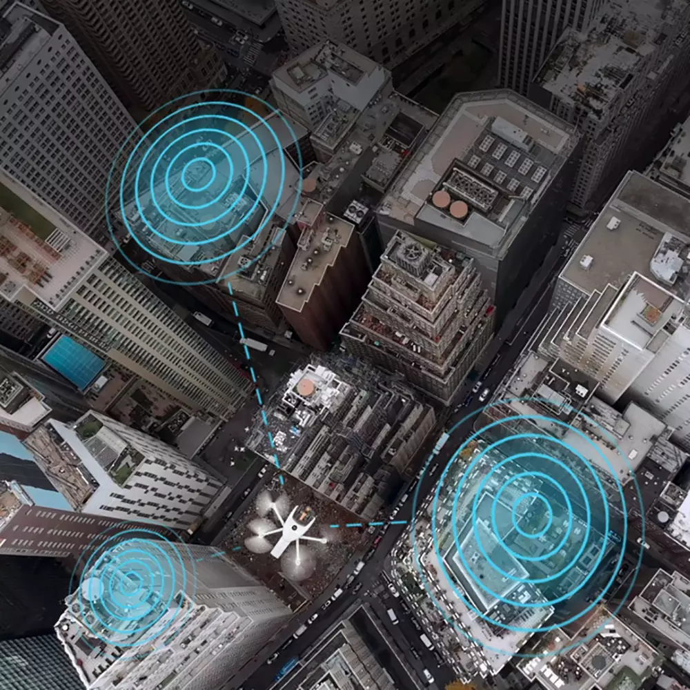
Parrot ANAFI Ai is the first drone to use a fast 4G data connection between the drone and the controller. This gives the drone a longer range and allows the drone to fly beyond visual range, such as behind buildings and other obstacles.
- IP53-rated splash-proof and dust-proof body
- 4G data connection between the helicopter and the controller
- 48MP main camera
- Works directly with PIX4d mapping software, among others
- Ready to fly in 60 seconds
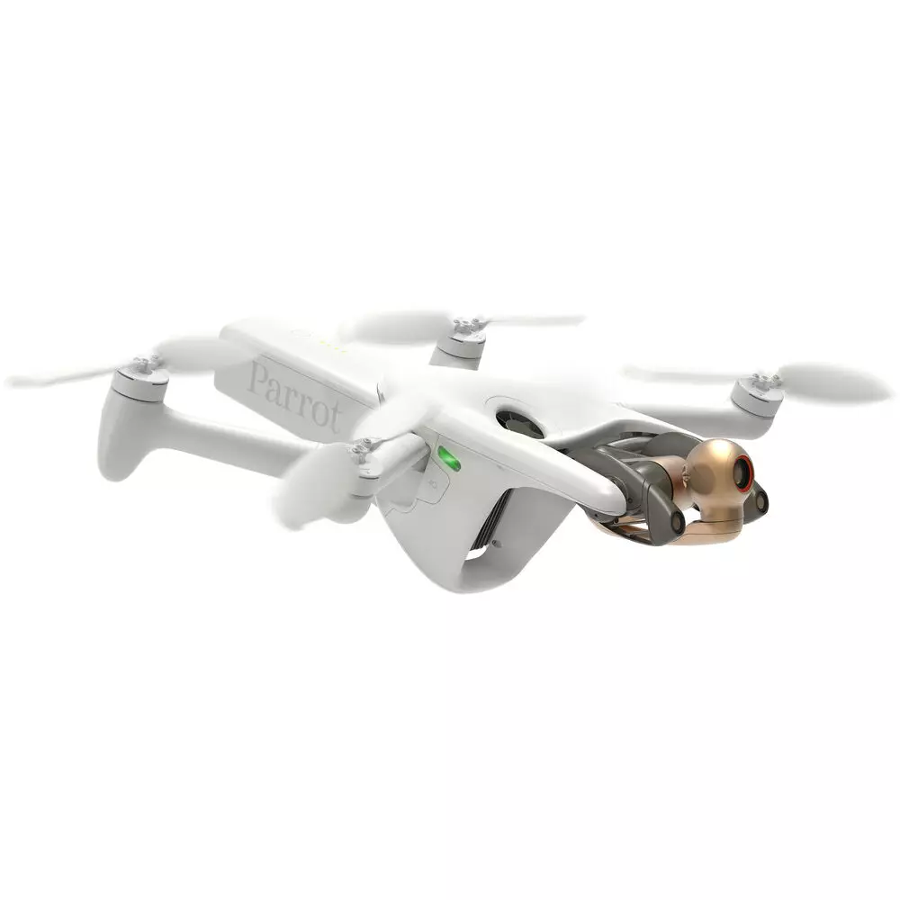
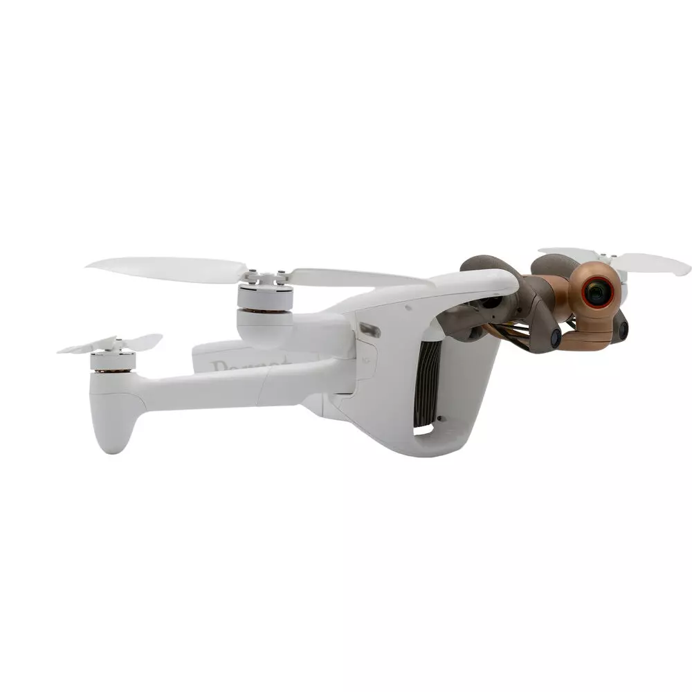
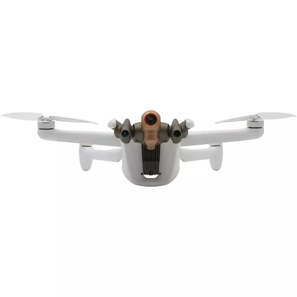
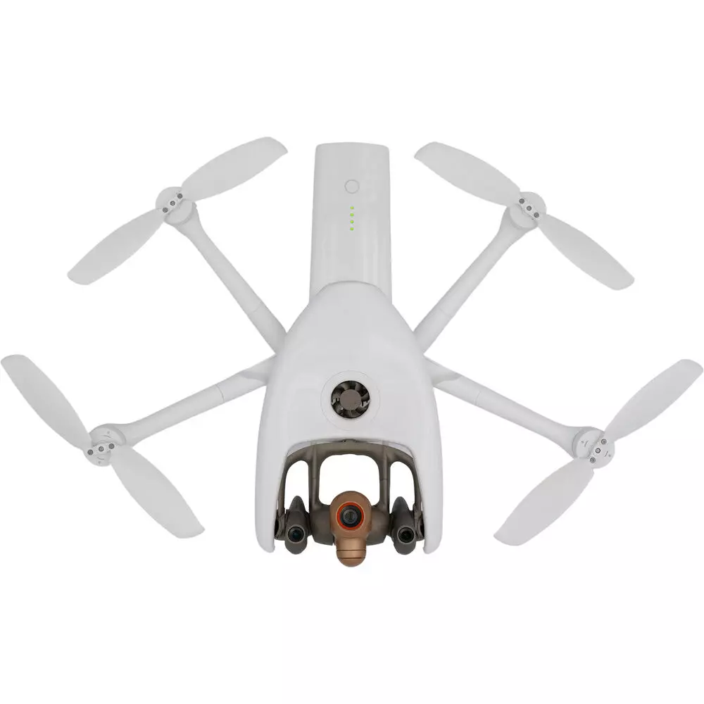
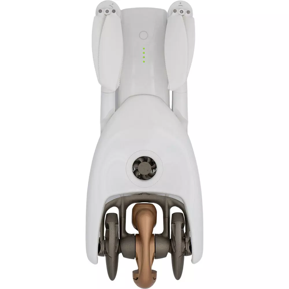
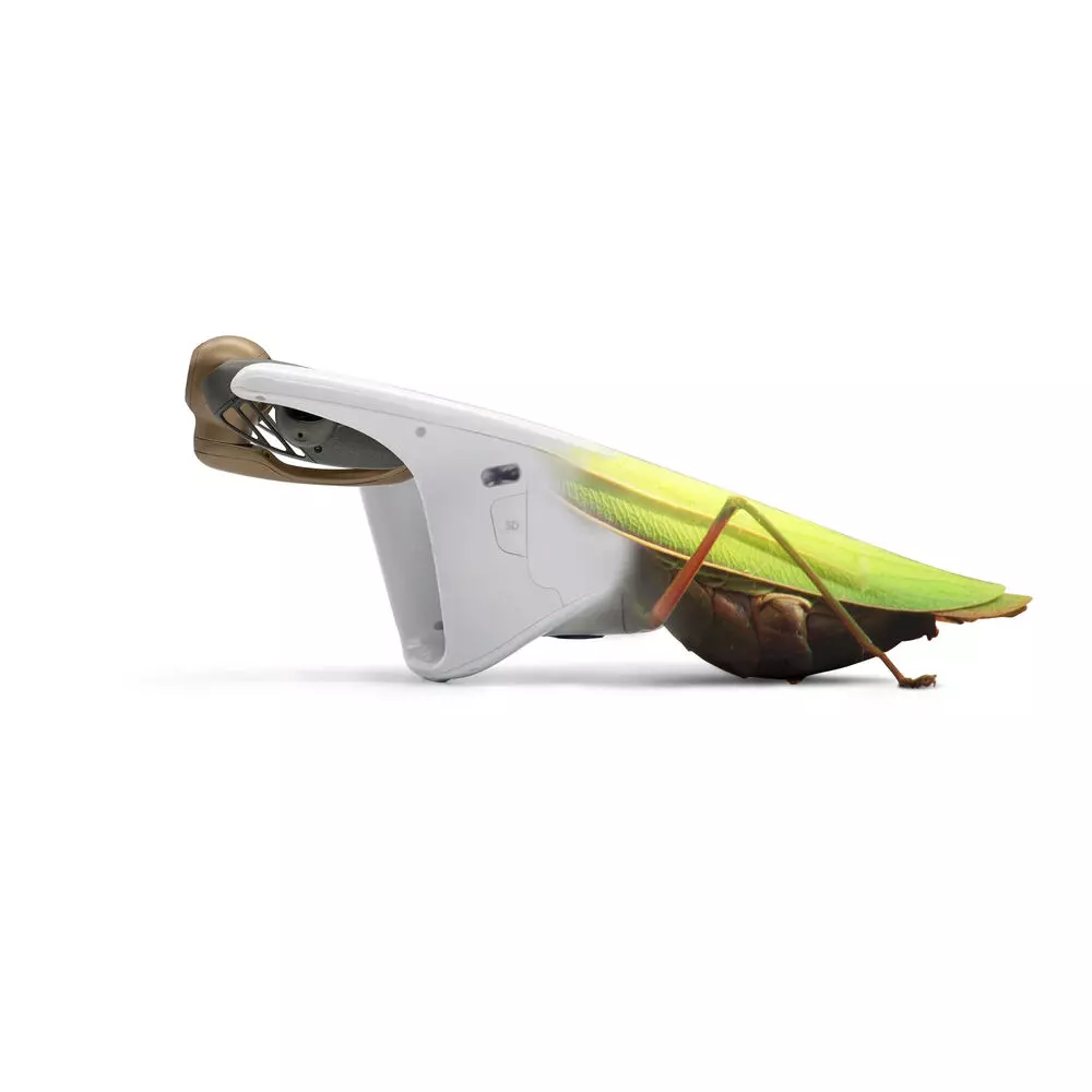
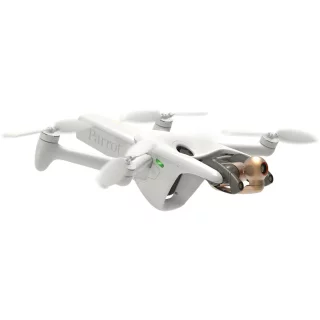
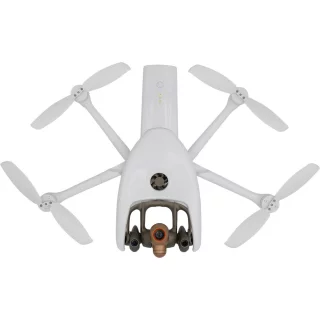
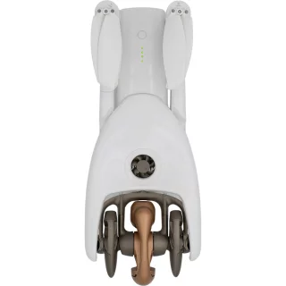
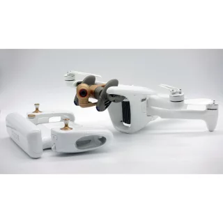
The Parrot ANAFI Ai drone's design language is inspired by nature. The drone has sleek lines and its protruding camera resembles an animal's head. The design allows the camera to move smoothly according to the shooting needs. This also allows the drone to move smoothly and can dynamically plan its flight path to avoid various obstacles.
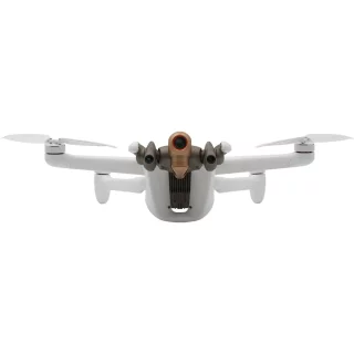
The 6x optical zoom of the drone is designed for a 48-megapixel camera. It allows professionals to observe details as small as a centimeter from a distance of up to 75 meters. The Quad Bayer sensors of the drone enable accurate HDR10-level color saturation in a wide range of lighting conditions (EV 14). In addition, the camera gimbal can be adjusted with a rotation range of up to 180 degrees (-90° – +90°), which allows for challenging angles, such as shooting the underside of bridge structures. Thanks to the advanced six-axis image stabilization, images remain accurate in strong crosswinds of up to 12.7 meters per second. The P-Log recording format allows for lossless recording of footage.
The helicopter's artificial intelligence enables the planning of complex flight paths and the filming of filming targets. Thanks to these, the helicopter can create accurate two- and three-dimensional models of environments, including natural features and buildings. Compared to a standard helicopter equipped with a 20-megapixel sensor, the Parrot ANAFI Ai can fly one and a half times higher, saving time and effort. For example, sharp GSD soil modeling can be taken from a height of 30 meters with a resolution of 0.46 cm/pixel. Modeling images can be taken at a rate of one frame per second, which is up to twice as fast as other filming helicopters on the market.
Images captured with the Parrot ANAFI Ai are compatible with all terrain modeling software. Compatibility is taken to the next level with the leading PIX4D software, which allows images to be transferred directly to the PIX4Dcloud cloud service for processing. This significantly speeds up and improves image processing time.
Parrot’s comprehensive ecosystem includes a huge number of specialized applications and services for a wide range of professional uses. Parrot is also the first manufacturer in the industry to make its control software an open source platform. Parrot offers software developers an SDK that allows companies to create customized commands for the Parrot ANAFI Ai imaging drone. The SDK gives programmers access to flight sensors, flight algorithms and internet connections. Thanks to its versatile software compatibility, the drone can be used in a wide range of software development.
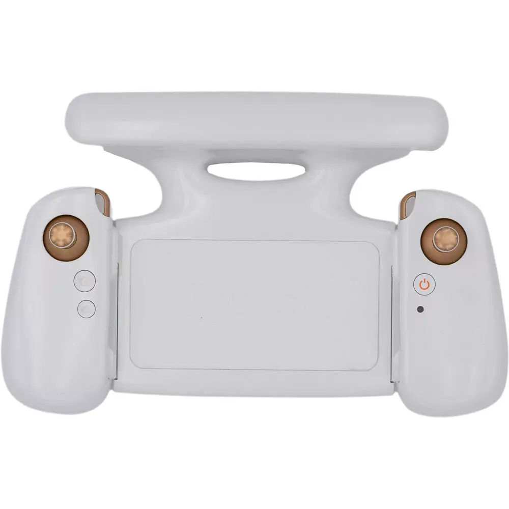
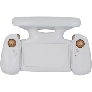
The Parrot ANAFI Ai drone and its Skycontroller 4 controller are protected by WISeKey Secure Element encryption technology. This ensures that both the drone’s software and the data it transmits are kept completely secure. Data encryption and privacy features comply with the European Union’s General Data Protection Regulation (GDPR). The drone uses trusted standards and open protocols to ensure the highest possible compatibility and security for all stored data.
ANAFI AI drone
- Dimensions when folded: 304 x 130 x 118 mm
- Dimensions in flight condition: 320 x 440 x 118 mm
- Weight: 898g / 1.98lb
- Flight time: up to 32 min in ideal conditions
- Maximum speed (horizontal): 16 m/s
- Maximum speed (vertical): 4 m/s
- Wind resistance: 14 m/s during flight & 12 m/s during takeoff and landing
- Maximum propeller rotation speed: 10,000 rpm
- Service Ceiling: 5,000 m (above sea level)
- Delivery temperature: -10°C to 40°C
- IP53 rated: splash-proof and dust-proof body
- Noise: 81 dB (at 1 meter)
- MicroSD and SIM card slots
Imaging system
- Sensor: 1/2'' 48MP CMOS
- Dynamics: 14 EV in HDR mode
- Optical LD-ASPH (low dispersion aspheric lens):
- Aperture: f/2.0
- 35 mm focal equivalent: 24 mm
- Depth of field: 4.5 m to ?
- ISO range: 50 to 6400
- Electronic shutter speed: 1/15 s to 1/10000 s
- Zoom: 6x – lossless: up to 4x (1080p) & 2x (4K UHD)
- 6-axis stabilization:
Mechanical: 3-axis (pitch, roll and yaw)
Electronic (EIS): 3-axis (pitch, roll and yaw)
Controllable gimbal Tilt range: -90° to +90°
Video specs
- Resolution:
4K UHD: 3840x2160 - 24/25/30 fps
1080p: 1920x1080 - 24/25/30/48/50/60 fps
HDR 10: 4K UHD/1080p - 24/25/30 fps
HDR 8: at all resolutions - Horizontal field of view (HFOV): 68°
- Maximum bit rate: 200 Mbps
- P-log
Arvostelujen yhteenveto
Kysy tuotteesta
ma-pe 9-17 ja la 10-14
TIETOA

